DroneVault: Your central hub for drone inspections
Centralize inspection data and connect with verified drone providers. Upload your own results or outsource projects to professionals who deliver directly to your platform.
Centralize inspection data and connect with verified drone providers. Upload your own results or outsource projects to professionals who deliver directly to your platform.
Bring all your inspection files into one secure hub where projects stay organized and easy to share.
Photos, videos, point clouds, orthomosaics, CAD, and reports.
No more scattered drives or email chains. One link, controlled access.
Encrypted at rest and in transit. Role-based controls and audit logs.
Folders, tags, saved views, and quick previews for faster reviews.
No setup fees. Cancel anytime.
Post a job, get matched with vetted providers, and keep everything in one workflow.
Request aerial inspections from providers with relevant experience.
Turn raw captures into reports without adding headcount.
Ratings, work history, and safety credentials visible upfront.
Match coverage and timelines without long procurement cycles.
Define scope, location, skills, and timing
See vetted providers with relevant experience
Deliverables handed off in your DroneVault workspace
Clear scopes. Simple handoffs.
Use DroneVault for inspections, mapping, and reporting across these common workflows.
Power lines, substations, solar fields, wind assets.
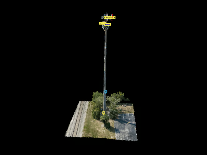
Cell towers, rooftop antennas, line-of-sight checks.
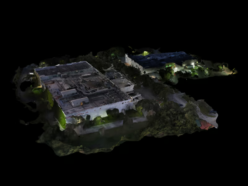
Progress tracking, cut/fill, as-built documentation.
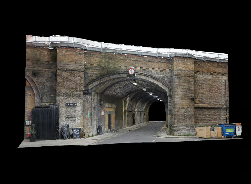
Roads, bridges, rail corridors, right-of-way surveys.
Pipelines, flare stacks, tank farms, leak detection.
Agriculture, mining, real estate, insurance, research, and any industry that benefits from aerial data.
All plans include unlimited projects and organizations. Processing is available through the DroneVault Network and priced per job.
Need data capture services? Post a job to our network of vetted drone professionals.
Imagery, 360°, thermal, point clouds, PDFs, and reports.
Viewers, editors, and admins with link passwords.
Track changes and review inspections side-by-side.
Client access without requiring an account.
Good for startups and small teams.
For growing teams and multi-site work.
For larger programs with custom needs.
Annual billing and additional storage bundles available on request. Data residency and retention options for Enterprise.
Time and cost improvements compared to previous workflows.
Fire & Rescue Services
"The thermal imaging and 3D models from our building assessments help our team plan emergency responses 80% faster. The fire chief was so impressed with the detail that we're now using it for all hazmat facility inspections. The shared links make briefing first responders incredibly efficient."
Commercial Drone Services
"We've increased our project margins by 40% since switching to DroneVault. The automated processing saves us 15 hours per week, and clients love the interactive reports. The ROI was clear within the first month - we've already paid for itself three times over with just our telecom tower contracts."
Real Estate & Construction Services
"The 3D models are game-changing for our real estate clients. We've closed 60% more listings because buyers can explore properties remotely. The virtual tours generated from our aerial footage have become our biggest selling point - clients specifically request us because of the DroneVault deliverables."
Environmental & Emergency Response
"DroneVault has revolutionized our emergency response planning. The 360° panoramas and thermal overlays help us identify chemical leak sources 90% faster than ground surveys. Our insurance clients save $50K per incident because we can assess sites remotely first. The per-project pricing model fits our emergency response budget perfectly."
Professional Drone Services
"This is a differentiator. Those that aren't able to provide visualization but are just doing raw footage — this gives you that competitive edge."
Solar Energy Solutions
"We've cut our solar panel inspection time in half. The thermal imaging integration and automated reporting have transformed how we handle maintenance contracts. Our clients love getting professional reports within hours instead of days."
💡 Want to see your potential savings?
Try our ROI calculators →Inspect, monitor, plan, and manage industrial sites efficiently with spatial analysis, automated reporting, and our scanning and analysis services.
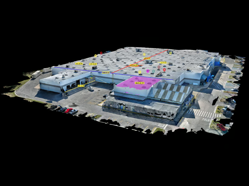
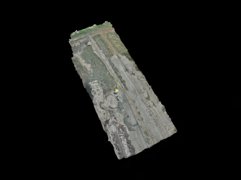
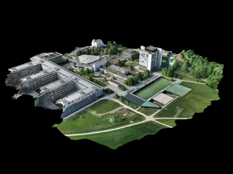
Get startedA few real outputs you can host and share from DroneVault.
Inspections keep critical infrastructure safe, but too often they are difficult to coordinate and inconsistent in quality. DroneVault was founded in 2021 to change that by connecting industrial facilities with specialists who know how to work in high-stakes environments. The early missions focused on assets where precision mattered most, such as pipelines, towers, government buildings, and refineries.
From those first projects the platform has grown into a nationwide network. More than 3,000 inspections have been hosted to date, carried out by certified professionals across all 50 states. Our partners bring expertise in digital twins, 3D modeling, terrain mapping, thermal imaging for energy audits, oil and gas inspections, and telecom and construction surveys. These services have been applied across schools, healthcare facilities, government buildings, energy sites, and large-scale infrastructure projects. Veteran-owned businesses strengthen the network by contributing discipline and safety-first practices to complex work.
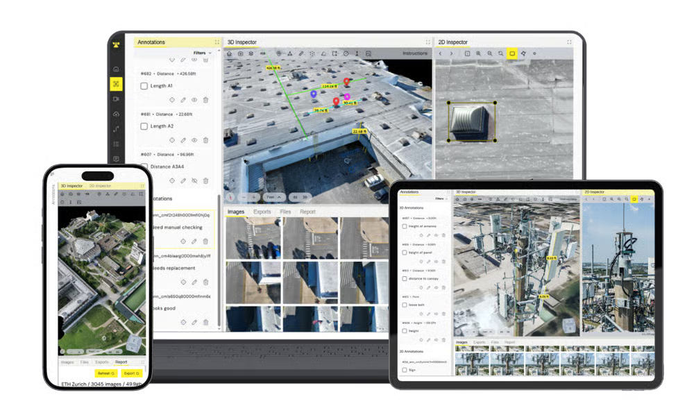
DroneVault has also evolved through direct feedback from partners. Their requests led to features such as automated report generation, comparison tools, access controls, annotations, measurement options, camera position tracking, and the ability to attach files like PDFs to complete reports. These improvements reflect a simple goal: to provide one platform where inspections can be scheduled, executed, and turned into professional reports that stakeholders can act on with confidence.
DroneVault's mission is to simplify inspections for asset owners and empower providers to deliver them efficiently.
Facility managers, engineers, and asset owners can easily request inspections and access data they can rely on.
Partners use DroneVault to communicate with clients, manage projects, and complete inspections without friction.
A single platform where scheduling, data hosting, measurements, annotations, comparisons, and reporting all come together.
Join thousands of professionals who trust DroneVault for their inspection workflows.
No setup fees. Cancel anytime. Get started in minutes.
Ready to streamline your industrial inspections? We'd love to hear from you.